
Doe een donatie
Rust jezelf uit voor je volgende avontuur:
Als Amazon-partner verdient deze site een commissie op in aanmerking komende aankopen, zonder extra kosten voor jou.
Topografische kaart Tseax Cone
Klik op de kaart om de hoogte weer te geven.
Doe een donatie
Rust jezelf uit voor je volgende avontuur:
Als Amazon-partner verdient deze site een commissie op in aanmerking komende aankopen, zonder extra kosten voor jou.
Tseax Cone
Tseax Cone (/ˈsiːæks/ SEE-aks) is a small volcano in the Nass Ranges of the Hazelton Mountains in northwestern British Columbia, Canada. It has an elevation of 609 metres (1,998 feet) and lies within an east–west valley through which a tributary of the Tseax River flows. The volcano consists of two nested structures and was the source of four lava flows that descended into neighbouring valleys. A secondary eruptive centre lies just north of Tseax Cone on the opposite side of Melita Lake. It probably formed simultaneously with Tseax Cone, but the timing of volcanism at the two eruptive centres is not precisely known; both were formed by volcanic activity sometime in the last 800 years.
Doe een donatie
Rust jezelf uit voor je volgende avontuur:
Als Amazon-partner verdient deze site een commissie op in aanmerking komende aankopen, zonder extra kosten voor jou.
Over deze kaart
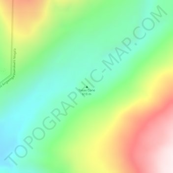
Naam: Topografische kaart Tseax Cone, hoogte, reliëf.
Gemiddelde hoogte: 723 m
Minimale hoogte: 434 m
Maximale hoogte: 1.210 m
Doe een donatie
Rust jezelf uit voor je volgende avontuur:
Als Amazon-partner verdient deze site een commissie op in aanmerking komende aankopen, zonder extra kosten voor jou.
Andere topografische kaarten
Klik op een kaart om zijn topografie, zijn hoogte en zijn reliëf te bekijken.
Munro Lake
Canada > British Columbia > Regional District of Kitimat-Stikine > Area A (Nass Valley/Bell Irving)
Gemiddelde hoogte: 707 m
Tom Mackay Lake
Canada > British Columbia > Regional District of Kitimat-Stikine > Area A (Nass Valley/Bell Irving)
Gemiddelde hoogte: 1.138 m
Border Lake Provincial Park
Canada > British Columbia > Regional District of Kitimat-Stikine > Area A (Nass Valley/Bell Irving)
Gemiddelde hoogte: 308 m
Sandal Lake
Canada > British Columbia > Regional District of Kitimat-Stikine > Area A (Nass Valley/Bell Irving)
Gemiddelde hoogte: 379 m
Doe een donatie
Rust jezelf uit voor je volgende avontuur:
Als Amazon-partner verdient deze site een commissie op in aanmerking komende aankopen, zonder extra kosten voor jou.
Derrick Lake
Canada > British Columbia > Regional District of Kitimat-Stikine > Area A (Nass Valley/Bell Irving)
Gemiddelde hoogte: 476 m