
Topografische kaart Ormiston
Interactieve kaart
Klik op de kaart om de hoogte weer te geven.
Ormiston
Ormiston is a village in East Lothian, Scotland, near Tranent, Humbie, Pencaitland and Cranston, located on the north bank of the River Tyne at an elevation of about 276 feet (84 m).
Over deze kaart
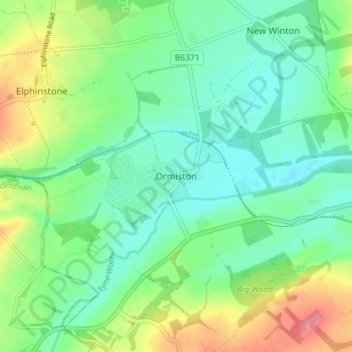
Naam: Topografische kaart Ormiston, hoogte, reliëf.
Locatie: Ormiston, East Lothian, Scotland, EH35 5HN, United Kingdom (55.89285 -2.95984 55.93285 -2.91984)
Gemiddelde hoogte: 102 m
Minimale hoogte: 75 m
Maximale hoogte: 159 m