
Topografische kaart Chester
Interactieve kaart
Klik op de kaart om de hoogte weer te geven.
Over deze kaart
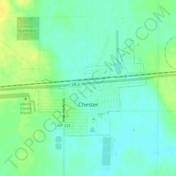
Naam: Topografische kaart Chester, hoogte, reliëf.
Locatie: Chester, Liberty County, Montana, 59522, United States (48.50549 -110.97888 48.52014 -110.95384)
Gemiddelde hoogte: 959 m
Minimale hoogte: 950 m
Maximale hoogte: 972 m
Lake Elwell, 15 miles (24 km) southwest of Chester, offer opportunities for boating, skiing, camping, picnicking, and both freshwater fishing and ice fishing. Fishing and floating are also available on the Marias River downstream from Tiber Dam. The Sweet Grass Hills to the north are the highest elevation peaks east of Glacier Park within 30 miles (48 km) of Highway 2. Hunting for deer, antelope, game birds, and elk is popular in the fall.