
Topografische kaart Tura
Interactieve kaart
Klik op de kaart om de hoogte weer te geven.
Over deze kaart
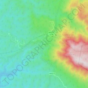
Naam: Topografische kaart Tura, hoogte, reliëf.
Locatie: Tura, Gambegre, West Garo Hills, Meghalaya, 794001, India (25.47256 90.17715 25.55256 90.25715)
Gemiddelde hoogte: 408 m
Minimale hoogte: 73 m
Maximale hoogte: 1.236 m
Tura is located at 25°31′N 90°13′E / 25.52°N 90.22°E / 25.52; 90.22. It has an average elevation of 349 metres (1145 feet). Its climate is a Humid Subtropical climate (Köppen climate classification: Cwa).