
Topografische kaart Calanda
Interactieve kaart
Klik op de kaart om de hoogte weer te geven.
Over deze kaart
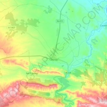
Naam: Topografische kaart Calanda, hoogte, reliëf.
Locatie: Calanda, Bajo Aragón, Teruel, Aragon, 44570, Espagne (40.88533 -0.32371 41.00816 -0.14881)
Gemiddelde hoogte: 504 m
Minimale hoogte: 327 m
Maximale hoogte: 830 m