
Topografische kaart Tirur
Interactieve kaart
Klik op de kaart om de hoogte weer te geven.
Tirur
Tirur is a Town and municipality in Malappuram district in the Indian state of Kerala spread over an area of 62.34 square kilometres (24.07 sq mi). It is one of the business centers of Malappuram district and is situated 26 kilometres (16 mi) west of Malappuram and 52.5 kilometres (32.6 mi) south of Kozhikode, on the Shoranur–Mangalore section of the Mangalore–Chennai railway line. Tirur is also a major regional trading centre for fish and betel leaf and has an average elevation of 2 metres (6 ft 7 in).
Over deze kaart
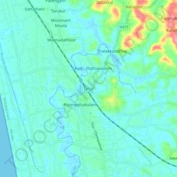
Naam: Topografische kaart Tirur, hoogte, reliëf.
Locatie: Tirur, Malappuram, Kerala, 676101, India (10.87676 75.88395 10.95676 75.96395)
Gemiddelde hoogte: 15 m
Minimale hoogte: -2 m
Maximale hoogte: 88 m