Topografische kaart Ivy Lea
Interactieve kaart
Klik op de kaart om de hoogte weer te geven.
Over deze kaart
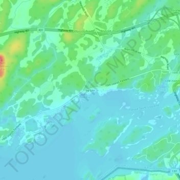
Naam: Topografische kaart Ivy Lea, hoogte, reliëf.
Gemiddelde hoogte: 87 m
Minimale hoogte: 72 m
Maximale hoogte: 147 m

Klik op de kaart om de hoogte weer te geven.
Naam: Topografische kaart Ivy Lea, hoogte, reliëf.
Gemiddelde hoogte: 87 m
Minimale hoogte: 72 m
Maximale hoogte: 147 m