
Topografische kaart Włodawa
Interactieve kaart
Klik op de kaart om de hoogte weer te geven.
Over deze kaart
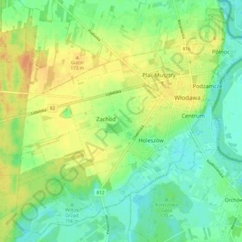
Naam: Topografische kaart Włodawa, hoogte, reliëf.
Locatie: Włodawa, Włodawa County, Lublin Voivodeship, 22-200, Poland (51.51552 23.48950 51.56708 23.57810)
Gemiddelde hoogte: 166 m
Minimale hoogte: 151 m
Maximale hoogte: 184 m