
Topografische kaart Pinlaung Township
Interactieve kaart
Klik op de kaart om de hoogte weer te geven.
Pinlaung Township
Pinlaung Township accounts for the largest area of tea cultivation in southern Shan State. The Tea grown here is of the Assamica cultivar. Tea plantations in the area cover 12,000 acres, with half of the cultivation taking place in the higher elevations of Le Hlaung, 10 miles from Pinlaung. In the Koe Khaung ward, tea production is refined and the tea coming from the nearly 100 tea-producing households is highly sought after. Farmers here use stoves with chimneys and clean pans for roasting, which creates a smoother teat that fetches higher prices than other teas in the region.
Over deze kaart
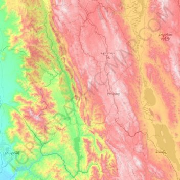
Naam: Topografische kaart Pinlaung Township, hoogte, reliëf.
Gemiddelde hoogte: 964 m
Minimale hoogte: 84 m
Maximale hoogte: 1.838 m