Topografische kaart Ile-à-la-Crosse
Interactieve kaart
Klik op de kaart om de hoogte weer te geven.
Over deze kaart
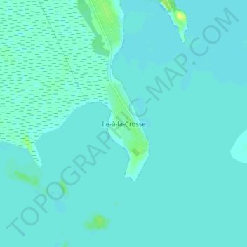
Naam: Topografische kaart Ile-à-la-Crosse, hoogte, reliëf.
Gemiddelde hoogte: 420 m
Minimale hoogte: 417 m
Maximale hoogte: 432 m

Klik op de kaart om de hoogte weer te geven.
Naam: Topografische kaart Ile-à-la-Crosse, hoogte, reliëf.
Gemiddelde hoogte: 420 m
Minimale hoogte: 417 m
Maximale hoogte: 432 m