Topografische kaart La Haute Forière
Interactieve kaart
Klik op de kaart om de hoogte weer te geven.
Over deze kaart
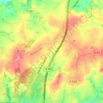
Naam: Topografische kaart La Haute Forière, hoogte, reliëf.
Gemiddelde hoogte: 167 m
Minimale hoogte: 118 m
Maximale hoogte: 204 m

Klik op de kaart om de hoogte weer te geven.
Naam: Topografische kaart La Haute Forière, hoogte, reliëf.
Gemiddelde hoogte: 167 m
Minimale hoogte: 118 m
Maximale hoogte: 204 m