
Topografische kaart Greater Makalali Private Game Reserve
Interactieve kaart
Klik op de kaart om de hoogte weer te geven.
Over deze kaart
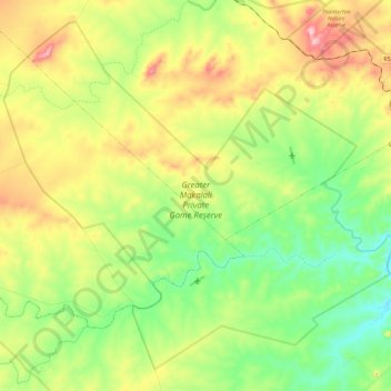
Naam: Topografische kaart Greater Makalali Private Game Reserve, hoogte, reliëf.
Gemiddelde hoogte: 510 m
Minimale hoogte: 390 m
Maximale hoogte: 702 m
Andere topografische kaarten
Klik op een kaart om zijn topografie, zijn hoogte en zijn reliëf te bekijken.
Mkhuhlu
RSA > Limpopo > Ba-Phalaborwa Local Municipality
Mkhuhlu, Ba-Phalaborwa Local Municipality, Mopani District Municipality, Limpopo, RSA
Gemiddelde hoogte: 318 m
Selati River
RSA > Limpopo > Ba-Phalaborwa Local Municipality
Selati River, Ba-Phalaborwa Local Municipality, Mopani District Municipality, Limpopo, RSA
Gemiddelde hoogte: 411 m