
Topografische kaart Truro
Interactieve kaart
Klik op de kaart om de hoogte weer te geven.
Truro
Truro (postcode 5356, altitude 311m) is a town in South Australia, 80 km northeast of Adelaide. It is situated in an agricultural and pastoral district on the Sturt Highway, east of the Barossa Valley, where the highway crosses somewhat lofty and rugged parts of the Mount Lofty Ranges. At the 2021 census, Truro had a population of 523.
Over deze kaart
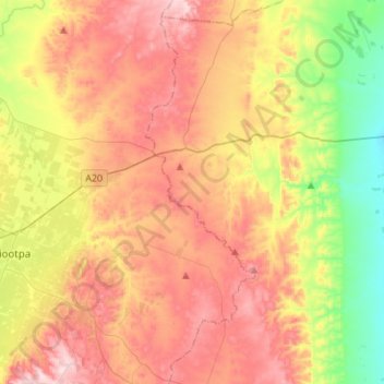
Naam: Topografische kaart Truro, hoogte, reliëf.
Gemiddelde hoogte: 320 m
Minimale hoogte: 121 m
Maximale hoogte: 518 m