
Topografische kaart Kollegal
Interactieve kaart
Klik op de kaart om de hoogte weer te geven.
Over deze kaart
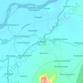
Naam: Topografische kaart Kollegal, hoogte, reliëf.
Gemiddelde hoogte: 645 m
Minimale hoogte: 625 m
Maximale hoogte: 901 m
Kollegala is located at 12°09′N 77°07′E / 12.15°N 77.12°E / 12.15; 77.12. It has an average elevation of 588 m (1,929 ft). Since the town is on the foothills of the Western Ghats, it is home to a mixed topography. Temperature is moderate.