
Topografische kaart Rupert
Interactieve kaart
Klik op de kaart om de hoogte weer te geven.
Over deze kaart
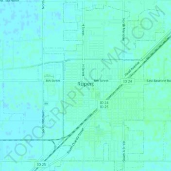
Naam: Topografische kaart Rupert, hoogte, reliëf.
Locatie: Rupert, Minidoka County, Idaho, 83350, United States (42.60328 -113.68889 42.63409 -113.65804)
Gemiddelde hoogte: 1.268 m
Minimale hoogte: 1.265 m
Maximale hoogte: 1.270 m
Rupert is located in southern Minidoka County at an elevation of 4,157 feet (1,267 m) above sea level. It is part of the agricultural region of the Snake River Plain known as Magic Valley, and is 3 miles (5 km) northwest of the Snake River. Interstate 84 passes 5 miles (8 km) to the south, and before its construction, U.S. Route 30 passed through Rupert. Acequia lies about 5 miles (8 km) northeast of Rupert and Jackson is about 4 miles (6 km) east of Rupert on the Snake River of Minidoka County and Cassia County of Idaho and Paul is about the same distance to the west.
Andere topografische kaarten
Klik op een kaart om zijn topografie, zijn hoogte en zijn reliëf te bekijken.
Heyburn
United States > Idaho > Minidoka County
Heyburn, Minidoka County, Idaho, 83336, United States
Gemiddelde hoogte: 1.265 m