
Topografische kaart Bustancilles
Interactieve kaart
Klik op de kaart om de hoogte weer te geven.
Over deze kaart
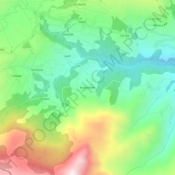
Naam: Topografische kaart Bustancilles, hoogte, reliëf.
Locatie: Bustancilles, Soba, Asón-Agüera, Cantabria, 39806, España (43.15828 -3.57291 43.19828 -3.53291)
Gemiddelde hoogte: 586 m
Minimale hoogte: 256 m
Maximale hoogte: 1.179 m