
Topografische kaart Jollyville Plateau
Interactieve kaart
Klik op de kaart om de hoogte weer te geven.
Over deze kaart
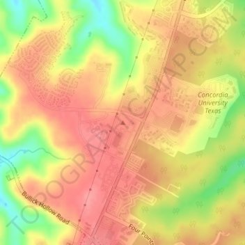
Naam: Topografische kaart Jollyville Plateau, hoogte, reliëf.
Locatie: Jollyville Plateau, Austin, Travis County, Texas, 78726, USA (30.41654 -97.85004 30.41664 -97.84994)
Gemiddelde hoogte: 297 m
Minimale hoogte: 246 m
Maximale hoogte: 324 m
Andere topografische kaarten
Klik op een kaart om zijn topografie, zijn hoogte en zijn reliëf te bekijken.
Stephenson Nature Preserve And Outdoor Education Center
Stephenson Nature Preserve And Outdoor Education Center, West William Cannon Drive, Whispering Oaks, Austin, Travis County, Texas, 78749, USA
Gemiddelde hoogte: 230 m
Balcones District Park
Balcones District Park, 12017, North Loop Business Park, Austin, Travis County, Texas, 78759, USA
Gemiddelde hoogte: 235 m
Red Bud Isle
Red Bud Isle, Austin, Travis County, Texas, USA
Gemiddelde hoogte: 181 m