
Topografische kaart Annandale-on-Hudson
Interactieve kaart
Klik op de kaart om de hoogte weer te geven.
Over deze kaart
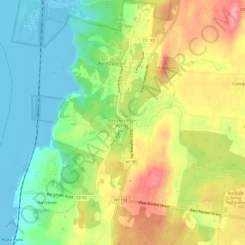
Naam: Topografische kaart Annandale-on-Hudson, hoogte, reliëf.
Gemiddelde hoogte: 43 m
Minimale hoogte: -6 m
Maximale hoogte: 96 m
Andere topografische kaarten
Klik op een kaart om zijn topografie, zijn hoogte en zijn reliëf te bekijken.
Barrytown
United States > New York > Dutchess County > Town of Red Hook
Barrytown, Town of Red Hook, Dutchess County, New York, 12507, United States
Gemiddelde hoogte: 26 m
Cokertown
United States > New York > Dutchess County > Town of Red Hook
Cokertown, Town of Red Hook, Dutchess County, New York, 12571, United States
Gemiddelde hoogte: 106 m