
Topografische kaart Brassfield
Interactieve kaart
Klik op de kaart om de hoogte weer te geven.
Over deze kaart
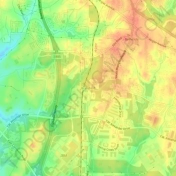
Naam: Topografische kaart Brassfield, hoogte, reliëf.
Gemiddelde hoogte: 113 m
Minimale hoogte: 85 m
Maximale hoogte: 133 m
Andere topografische kaarten
Klik op een kaart om zijn topografie, zijn hoogte en zijn reliëf te bekijken.
Few
United States > North Carolina > Durham County > Durham
Few, Durham, Durham County, North Carolina, 27713, United States
Gemiddelde hoogte: 102 m
Durham
United States > North Carolina > Durham County > Durham
Durham, Durham County, North Carolina, 27701, United States
Gemiddelde hoogte: 119 m
Belmont Lake
United States > North Carolina > Durham County > Durham
Belmont Lake, Crest Street, Durham, Durham County, North Carolina, United States
Gemiddelde hoogte: 117 m
Hayes
United States > North Carolina > Durham County > Durham
Hayes, Durham, Durham County, North Carolina, 27702, United States
Gemiddelde hoogte: 115 m