
Topografische kaart Sioux County
Interactieve kaart
Klik op de kaart om de hoogte weer te geven.
Over deze kaart
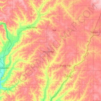
Naam: Topografische kaart Sioux County, hoogte, reliëf.
Locatie: Sioux County, Iowa, United States (42.90908 -96.57149 43.26003 -95.85839)
Gemiddelde hoogte: 418 m
Minimale hoogte: 351 m
Maximale hoogte: 466 m
Andere topografische kaarten
Klik op een kaart om zijn topografie, zijn hoogte en zijn reliëf te bekijken.
Chatsworth
United States > Iowa > Sioux County > Chatsworth > Chatsworth
Chatsworth, Sioux County, Iowa, 51011, United States
Gemiddelde hoogte: 359 m
Chatsworth
United States > Iowa > Sioux County
Chatsworth, Sioux County, Iowa, 51011, United States
Gemiddelde hoogte: 357 m
Hawarden
United States > Iowa > Sioux County
Hawarden, Sioux County, Iowa, United States
Gemiddelde hoogte: 365 m