
Topografische kaart Bathinda
Interactieve kaart
Klik op de kaart om de hoogte weer te geven.
Over deze kaart
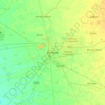
Naam: Topografische kaart Bathinda, hoogte, reliëf.
Gemiddelde hoogte: 208 m
Minimale hoogte: 199 m
Maximale hoogte: 218 m
Bathinda is in the northwestern region of India and is a part of the Indo-Gangetic alluvial plains. The exact cartographic co-ordinates of Bathinda are 30°12′N 74°57′E / 30.20°N 74.95°E / 30.20; 74.95. It has an average elevation of 201 metres (660 ft).