
Topografische kaart Strand
Interactieve kaart
Klik op de kaart om de hoogte weer te geven.
Over deze kaart
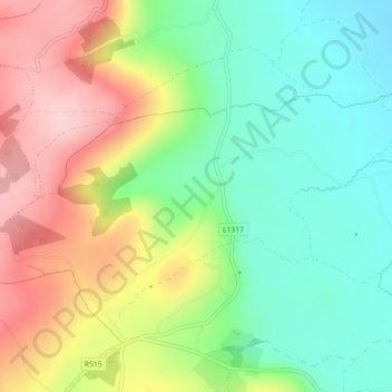
Naam: Topografische kaart Strand, hoogte, reliëf.
Gemiddelde hoogte: 170 m
Minimale hoogte: 86 m
Maximale hoogte: 287 m
Andere topografische kaarten
Klik op een kaart om zijn topografie, zijn hoogte en zijn reliëf te bekijken.
Ballyagran
Ireland > County Limerick > The Municipal District of Newcastle West
Gemiddelde hoogte: 97 m
Newcastle West
Ireland > County Limerick > The Municipal District of Newcastle West
Gemiddelde hoogte: 58 m