
Topografische kaart Pollock Pines
Interactieve kaart
Klik op de kaart om de hoogte weer te geven.
Over deze kaart
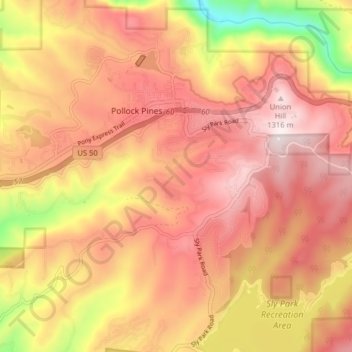
Naam: Topografische kaart Pollock Pines, hoogte, reliëf.
Gemiddelde hoogte: 1.118 m
Minimale hoogte: 727 m
Maximale hoogte: 1.344 m
Pollock Pines is a census-designated place (CDP) in El Dorado County, California, United States. It is part of the Sacramento–Arden-Arcade–Roseville Metropolitan Statistical Area. Pollock Pines lies at an elevation of 3,980 feet (1,210 m) in the Sierra Nevada. The population was 7,112 at the 2020 census, up from 6,871 at the 2010 census.