
Topografische kaart Grand Prairie
Klik op de kaart om de hoogte weer te geven.
Over deze kaart
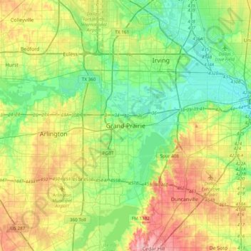
Naam: Topografische kaart Grand Prairie, hoogte, reliëf.
Locatie: Grand Prairie, Dallas County, Texas, 75051, United States (32.58596 -97.15778 32.90596 -96.83778)
Gemiddelde hoogte: 170 m
Minimale hoogte: 120 m
Maximale hoogte: 262 m