
Topografische kaart Tian Shan
Interactieve kaart
Klik op de kaart om de hoogte weer te geven.
Over deze kaart
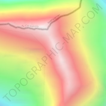
Naam: Topografische kaart Tian Shan, hoogte, reliëf.
Locatie: Tian Shan, Wensu County, Aksu Prefecture, Xinjiang, China (42.03089 80.20056 42.03099 80.20066)
Gemiddelde hoogte: 6.096 m
Minimale hoogte: 5.160 m
Maximale hoogte: 6.790 m
Continuous permafrost is typically found in the Tian Shan starting at the elevation of about 3,500-3,700 m above the sea level. Discontinuous alpine permafrost usually occurs down to 2,700-3,300 m, but in certain locations, due to the peculiarity of the aspect and the microclimate, it can be found at elevations as low as 2,000 m.