
Topografische kaart Nankai
Interactieve kaart
Klik op de kaart om de hoogte weer te geven.
Nankai
Nankai District is located in the south-west corner of the urban Tianjin, bordered by Hongqiao District to the north, Hebei and Heping Districts to the north-east, Hexi District to the east and Xiqing District to the south-west. It occupies an area of 40.64 square kilometres (15.69 sq mi). The natural topography is characterised by higher elevation in the north of the district and a lower elevation in the south, with the average altitude being 3 metres.
Over deze kaart
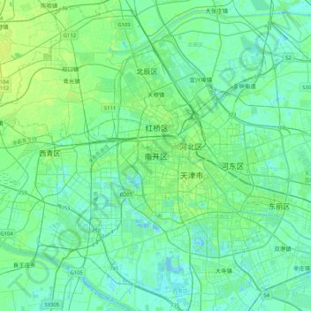
Naam: Topografische kaart Nankai, hoogte, reliëf.
Locatie: Nankai, Nankai District, Tianjin, 300084, China (38.97701 116.98395 39.29701 117.30395)
Gemiddelde hoogte: 5 m
Minimale hoogte: -5 m
Maximale hoogte: 19 m
Andere topografische kaarten
Klik op een kaart om zijn topografie, zijn hoogte en zijn reliëf te bekijken.