
Topografische kaart Kelseyville
Interactieve kaart
Klik op de kaart om de hoogte weer te geven.
Over deze kaart
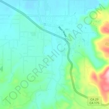
Naam: Topografische kaart Kelseyville, hoogte, reliëf.
Gemiddelde hoogte: 462 m
Minimale hoogte: 409 m
Maximale hoogte: 668 m
Kelseyville is a census-designated place (CDP) in Lake County, California, United States. Kelseyville is located 6 miles (9.7 km) southeast of Lakeport, at an elevation of 1,384 feet (422 m). The population was 3,353 at the 2010 census, up from 2,928 at the 2000 census.