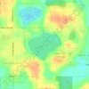
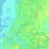
Topografische kaart Zephyrhills
Klik op de kaart om de hoogte weer te geven.
Zephyrhills
Zephyrhills is characterized by its gently rolling topography, which contributes to its picturesque landscape. The area's elevation ranges between approximately 70 and 140 feet above sea level, giving it a distinct relief compared to the flat expanses typical of much of central Florida. This rolling terrain, adorned with lush vegetation and surrounded by open spaces, enhances the region's charm and is integral to its identity. The land supports a mix of residential and recreational developments, including parks and natural reserves, which allow residents and visitors alike to enjoy the scenic beauty and outdoor activities that the topography facilitates.
Over deze kaart

Naam: Topografische kaart Zephyrhills, hoogte, reliëf.
Locatie: Zephyrhills, Pasco County, Florida, United States (28.19696 -82.24174 28.28826 -82.14495)
Gemiddelde hoogte: 32 m
Minimale hoogte: 17 m
Maximale hoogte: 71 m
Andere topografische kaarten
Klik op een kaart om zijn topografie, zijn hoogte en zijn reliëf te bekijken.
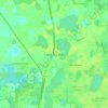


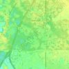
Wesley Chapel
United States > Florida > Pasco County
According to the United States Census Bureau, the CDP has a total area of 6.1 square miles (16 km2), of which 6.1 square miles (16 km2) is land and 0.04 square miles (0.10 km2) (0.49%) is water. The elevation is about 100 feet (30 m), combined with an inland location, creates more temperature variation in the…
Gemiddelde hoogte: 19 m

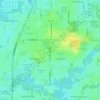

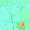


Wesley Chapel
United States > Florida > Pasco County
According to the United States Census Bureau, the CDP has a total area of 6.1 square miles (16 km2), of which 6.1 square miles (16 km2) is land and 0.04 square miles (0.10 km2) (0.49%) is water. The elevation is about 100 feet (30 m), combined with an inland location, creates more temperature variation in the…
Gemiddelde hoogte: 19 m

Wesley Chapel
United States > Florida > Pasco County
According to the United States Census Bureau, the CDP has a total area of 6.1 square miles (16 km2), of which 6.1 square miles (16 km2) is land and 0.04 square miles (0.10 km2) (0.49%) is water. The elevation is about 100 feet (30 m), combined with an inland location, creates more temperature variation in the…
Gemiddelde hoogte: 19 m