
Topografische kaart Linglestown
Interactieve kaart
Klik op de kaart om de hoogte weer te geven.
Linglestown
The highest elevation is 995 feet (303 m) on the south slope of Blue Mountain, along Blue Mountain Parkway north of the center of town. Pennsylvania Route 39 (Linglestown Road) passes east-to-west through the village, leading east 3.5 miles (5.6 km) to Exit 77 on Interstate 81 and west 5 miles (8 km) to Highway 22-322 at the north end of Harrisburg.
Over deze kaart
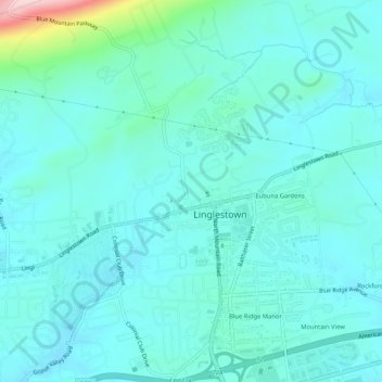
Naam: Topografische kaart Linglestown, hoogte, reliëf.
Gemiddelde hoogte: 161 m
Minimale hoogte: 124 m
Maximale hoogte: 376 m