Geolokaliseren

Topografische kaart Darby Island

Interactieve kaart

Klik op de kaart om de hoogte weer te geven.

Over deze kaart

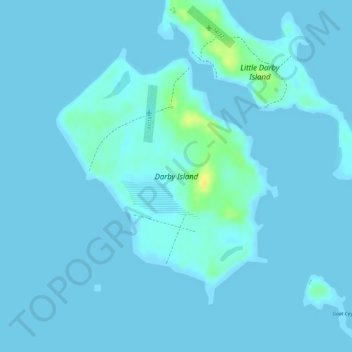
Naam: Topografische kaart Darby Island, hoogte, reliëf.

Locatie: Darby Island, Exuma, The Bahamas (23.83665 -76.23602 23.85644 -76.21734)

Gemiddelde hoogte: 2 m

Minimale hoogte: -1 m

Maximale hoogte: 25 m

Andere topografische kaarten

Klik op een kaart om zijn topografie, zijn hoogte en zijn reliëf te bekijken.

Great Exuma Island

The Bahamas > Exuma

Great Exuma Island, Exuma, The Bahamas

Gemiddelde hoogte: 1 m

Little Darby Island

The Bahamas > Exuma

Little Darby Island, Exuma, The Bahamas

Gemiddelde hoogte: 0 m

Little Halls Pond Cay

The Bahamas > Exuma

Little Halls Pond Cay, Exuma, The Bahamas

Gemiddelde hoogte: 0 m

Lee Stocking Island

The Bahamas > Exuma

Lee Stocking Island, Exuma, The Bahamas

Gemiddelde hoogte: 1 m

Staniel Cay

The Bahamas > Exuma

Staniel Cay, Exuma, The Bahamas

Gemiddelde hoogte: 2 m

Bock Cay

The Bahamas > Exuma

Bock Cay, Exuma, The Bahamas

Gemiddelde hoogte: 1 m