Topografische kaart Bradbourne
Klik op de kaart om de hoogte weer te geven.
Over deze kaart
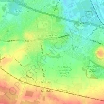
Naam: Topografische kaart Bradbourne, hoogte, reliëf.
Gemiddelde hoogte: 28 m
Minimale hoogte: 2 m
Maximale hoogte: 58 m

Klik op de kaart om de hoogte weer te geven.
Naam: Topografische kaart Bradbourne, hoogte, reliëf.
Gemiddelde hoogte: 28 m
Minimale hoogte: 2 m
Maximale hoogte: 58 m
Als Amazon-partner verdient deze site een commissie op in aanmerking komende aankopen, zonder extra kosten voor jou.