
Topografische kaart Santa Cruz Cuautomatitla
Interactieve kaart
Klik op de kaart om de hoogte weer te geven.
Over deze kaart
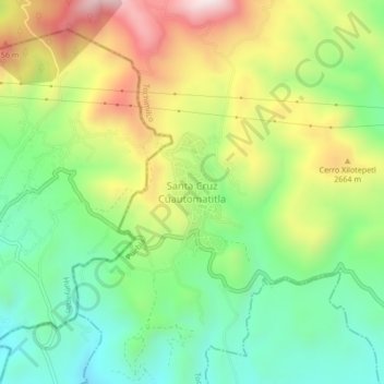
Naam: Topografische kaart Santa Cruz Cuautomatitla, hoogte, reliëf.
Locatie: Santa Cruz Cuautomatitla, Tochimilco, Puebla, Mexico (18.87244 -98.67925 18.91244 -98.63925)
Gemiddelde hoogte: 2.492 m
Minimale hoogte: 2.228 m
Maximale hoogte: 2.889 m