
Topografische kaart Carr Creek
Interactieve kaart
Klik op de kaart om de hoogte weer te geven.
Over deze kaart
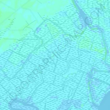
Naam: Topografische kaart Carr Creek, hoogte, reliëf.
Gemiddelde hoogte: 1 m
Minimale hoogte: -3 m
Maximale hoogte: 6 m
Andere topografische kaarten
Klik op een kaart om zijn topografie, zijn hoogte en zijn reliëf te bekijken.
Richard B. Russell Lake
United States of America > South Carolina > Barnes Station
Richard B. Russell Lake, Onnie Street, Barnes Station, Anderson County, South Carolina, 29655, United States of America
Gemiddelde hoogte: 180 m
Lakeside
United States of America > South Carolina > Florence > Lakeside
Lakeside, Florence, Florence County, South Carolina, 29504, United States of America
Gemiddelde hoogte: 37 m
Barton Creek
United States of America > South Carolina
Barton Creek, Greenville County, South Carolina, 29688, United States of America
Gemiddelde hoogte: 310 m
Keowee
United States of America > South Carolina > Keowee
Keowee, Oconee County, South Carolina, 29665, United States of America
Gemiddelde hoogte: 229 m
Datha Island
United States of America > South Carolina
Datha Island, Beaufort County, South Carolina, United States of America
Gemiddelde hoogte: 3 m
Westcliffe
United States of America > South Carolina > Westcliffe
Westcliffe, Berea, Greenville County, South Carolina, 29611, United States of America
Gemiddelde hoogte: 298 m
Flat Shoals
United States of America > South Carolina > Flat Shoals
Flat Shoals, Oconee County, South Carolina, 29686, United States of America
Gemiddelde hoogte: 307 m
Barberville
United States of America > South Carolina > Indian Land > Barberville
Barberville, Indian Land, Lancaster County, South Carolina, 28134, United States of America
Gemiddelde hoogte: 183 m
Johnston
United States of America > South Carolina > Johnston
Johnston, Edgefield County, South Carolina, United States of America
Gemiddelde hoogte: 190 m
The Village
United States of America > South Carolina > The Village
The Village, Charleston County, South Carolina, 29464, United States of America
Gemiddelde hoogte: 4 m
Wilsons Creek
United States of America > South Carolina
Wilsons Creek, Union County, South Carolina, United States of America
Gemiddelde hoogte: 129 m
Clubside Estates
United States of America > South Carolina > Clubside Estates
Clubside Estates, York County, South Carolina, United States of America
Gemiddelde hoogte: 174 m
Asheton Springs
United States of America > South Carolina > Asheton Springs
Asheton Springs, Greenville County, South Carolina, United States of America
Gemiddelde hoogte: 278 m