
Topografische kaart Woodland Park
Interactieve kaart
Klik op de kaart om de hoogte weer te geven.
Woodland Park
Woodland Park experiences an alpine subarctic climate (Dfc), due to its high elevation and its location in the Rocky Mountains. Summers are warm, but much milder than summers at lower elevations, such as in Colorado Springs, Denver, or the plains to the east. Nights are cool, even chilly in summer.
Over deze kaart
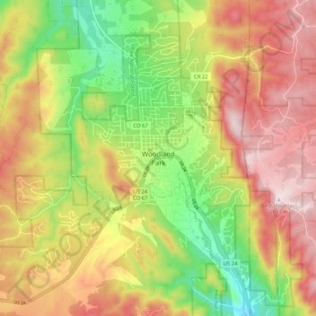
Naam: Topografische kaart Woodland Park, hoogte, reliëf.
Gemiddelde hoogte: 2.657 m
Minimale hoogte: 2.419 m
Maximale hoogte: 2.884 m