
Topografische kaart Lumsden
Interactieve kaart
Klik op de kaart om de hoogte weer te geven.
Over deze kaart
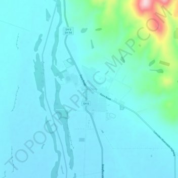
Naam: Topografische kaart Lumsden, hoogte, reliëf.
Gemiddelde hoogte: 221 m
Minimale hoogte: 183 m
Maximale hoogte: 472 m
Andere topografische kaarten
Klik op een kaart om zijn topografie, zijn hoogte en zijn reliëf te bekijken.
Mossburn
New Zealand > Southland > Southland District > Northern Community
Mossburn, Northern Community, Southland District, Southland, 9747, New Zealand
Gemiddelde hoogte: 299 m