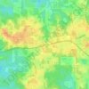
Topografische kaart Pensacola
Klik op de kaart om de hoogte weer te geven.
Pensacola
Pensacola features a diverse topography characterized primarily by its proximity to the Gulf of Mexico and the sheltered Pensacola Bay. The terrain gently slopes upward from the waterfront, resulting in a gradual elevation that provides natural protection against storm surges, making it somewhat less vulnerable to hurricanes compared to other coastal regions. The area encompasses approximately 105 square kilometers, with around 56% land and 44% water. The landscape includes sandy beaches, wetlands, and rolling hills, with elevations generally ranging from sea level up to about 120 feet above sea level in certain inland areas. This unique topography supports a rich array of ecosystems, including coastal marshes and forests, contributing to Pensacola's vibrant natural environment.
Over deze kaart
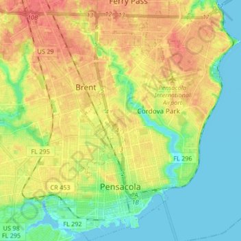
Naam: Topografische kaart Pensacola, hoogte, reliëf.
Locatie: Pensacola, Escambia County, Florida, United States (30.39554 -87.25889 30.51049 -87.14972)
Gemiddelde hoogte: 21 m
Minimale hoogte: -3 m
Maximale hoogte: 46 m
Andere topografische kaarten
Klik op een kaart om zijn topografie, zijn hoogte en zijn reliëf te bekijken.