
Topografische kaart Isla Vista
Interactieve kaart
Klik op de kaart om de hoogte weer te geven.
Over deze kaart
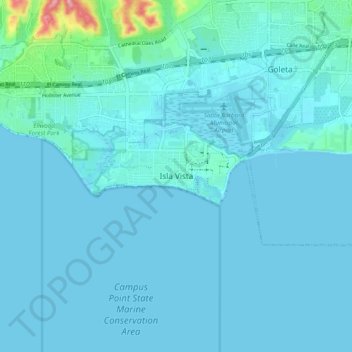
Naam: Topografische kaart Isla Vista, hoogte, reliëf.
Gemiddelde hoogte: 13 m
Minimale hoogte: -1 m
Maximale hoogte: 150 m
Isla Vista is an unincorporated community and census-designated place (CDP) in Santa Barbara County, California in the United States. As of the 2010 census, the CDP had a population of 23,096. The majority of residents are college students at nearby University of California, Santa Barbara (UCSB, located to the east of the community) or at Santa Barbara City College. The beachside community lies on a flat plateau about 30 feet (9 m) in elevation, separated from the beach by a bluff.