
Topografische kaart Urling
Interactieve kaart
Klik op de kaart om de hoogte weer te geven.
Over deze kaart
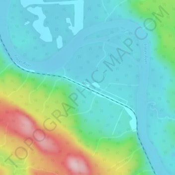
Naam: Topografische kaart Urling, hoogte, reliëf.
Gemiddelde hoogte: 696 m
Minimale hoogte: 632 m
Maximale hoogte: 895 m
Andere topografische kaarten
Klik op een kaart om zijn topografie, zijn hoogte en zijn reliëf te bekijken.
Tête Jaune Cache
Canada > British Columbia > Regional District of Fraser-Fort George > Area H (Robson Valley/Canoe)
Tête Jaune Cache, Area H (Robson Valley/Canoe), Regional District of Fraser-Fort George, British Columbia, Canada
Gemiddelde hoogte: 789 m
Mount Robson
Canada > British Columbia > Regional District of Fraser-Fort George > Area H (Robson Valley/Canoe)
Mount Robson, Area H (Robson Valley/Canoe), Regional District of Fraser-Fort George, British Columbia, Canada
Gemiddelde hoogte: 3.042 m
Goat River
Canada > British Columbia > Regional District of Fraser-Fort George > Area H (Robson Valley/Canoe)
Goat River, Area H (Robson Valley/Canoe), Regional District of Fraser-Fort George, British Columbia, Canada
Gemiddelde hoogte: 705 m
Eddy
Canada > British Columbia > Regional District of Fraser-Fort George > Area H (Robson Valley/Canoe)
Eddy, Area H (Robson Valley/Canoe), Regional District of Fraser-Fort George, British Columbia, Canada
Gemiddelde hoogte: 729 m
Mount Sir Mackenzie Bowell
Canada > British Columbia > Regional District of Fraser-Fort George > Area H (Robson Valley/Canoe)
Mount Sir Mackenzie Bowell, Area H (Robson Valley/Canoe), Regional District of Fraser-Fort George, British Columbia, Canada
Gemiddelde hoogte: 2.689 m
Crescent Spur
Canada > British Columbia > Regional District of Fraser-Fort George > Area H (Robson Valley/Canoe)
Crescent Spur, Area H (Robson Valley/Canoe), Regional District of Fraser-Fort George, British Columbia, Canada
Gemiddelde hoogte: 703 m