
Topografische kaart Union
Interactieve kaart
Klik op de kaart om de hoogte weer te geven.
Over deze kaart
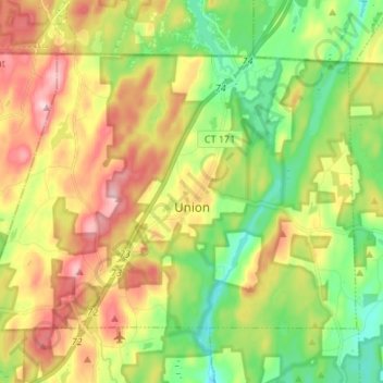
Naam: Topografische kaart Union, hoogte, reliëf.
Locatie: Union, Tolland County, Connecticut, United States (41.95837 -72.23438 42.03108 -72.09917)
Gemiddelde hoogte: 275 m
Minimale hoogte: 182 m
Maximale hoogte: 398 m