

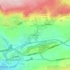
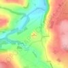
Topografische kaart Harrogate
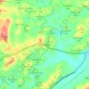
Klik op de kaart om de hoogte weer te geven.
Harrogate
Harrogate is situated on the edge of the Yorkshire Dales, with the Vale of York to the east and the upland Yorkshire Dales to the west and north-west. It has a dry and mild climate, typical of places in the rain shadow of the Pennines. It is on the A59 from Skipton to York. At an altitude of between 100 and 200 metres (330 and 660 ft), Harrogate is higher than many English settlements. It has an average minimum temperature in January of slightly below 0 °C (32 °F) and an average maximum in July and August of 20 °C (68 °F).
Over deze kaart

Naam: Topografische kaart Harrogate, hoogte, reliëf.
Locatie: Harrogate, North Yorkshire, England, United Kingdom (53.89141 -2.00450 54.26160 -1.17500)
Gemiddelde hoogte: 131 m
Minimale hoogte: 4 m
Maximale hoogte: 568 m
Andere topografische kaarten
Klik op een kaart om zijn topografie, zijn hoogte en zijn reliëf te bekijken.




Farndale
United Kingdom > England > North Yorkshire > Ryedale > Gillamoor
With the population having decreased greatly from the 668 that is recorded in "A Topographical Dictionary of Yorkshire" by Thomas Lansdale published in 1822 when farndale East side had a population of 455 and Farndale West Side had a Population of 213.
Gemiddelde hoogte: 273 m















Bolton Castle
United Kingdom > England > North Yorkshire > Redmire > Castle Bolton
Gemiddelde hoogte: 250 m


Thimbleby & Osmotherly Show field
United Kingdom > England > North Yorkshire > Thimbleby
Gemiddelde hoogte: 152 m









Killinghall
United Kingdom > England > North Yorkshire > Harrogate > Killinghall
Gemiddelde hoogte: 86 m



Ribblesdale
United Kingdom > England > North Yorkshire > Horton in Ribblesdale
Gemiddelde hoogte: 368 m

Willerby Brow Plantation
United Kingdom > England > North Yorkshire > Ryedale > Staxton > Binnington
Gemiddelde hoogte: 100 m