
Topografische kaart Yantai
Interactieve kaart
Klik op de kaart om de hoogte weer te geven.
Over deze kaart
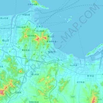
Naam: Topografische kaart Yantai, hoogte, reliëf.
Gemiddelde hoogte: 34 m
Minimale hoogte: -3 m
Maximale hoogte: 546 m
Yantai is located along the north coast of the Shandong Peninsula, south of the junction of Bohai Sea and Yellow Sea and parallel to the southern coast of Liaoning. The topographical breakdown consists of: