
Topografische kaart Manito
Interactieve kaart
Klik op de kaart om de hoogte weer te geven.
Over deze kaart
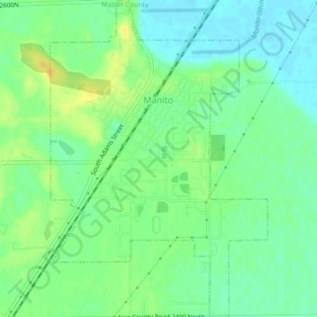
Naam: Topografische kaart Manito, hoogte, reliëf.
Locatie: Manito, Mason County, Illinois, United States (40.40567 -89.79253 40.43514 -89.76589)
Gemiddelde hoogte: 153 m
Minimale hoogte: 142 m
Maximale hoogte: 166 m
Andere topografische kaarten
Klik op een kaart om zijn topografie, zijn hoogte en zijn reliëf te bekijken.
Goofy Ridge
United States > Illinois > Mason County
Goofy Ridge, Mason County, Illinois, 61567, United States
Gemiddelde hoogte: 147 m
Forest City
United States > Illinois > Mason County
Forest City, Mason County, Illinois, United States
Gemiddelde hoogte: 153 m
Wolf Lake
United States > Illinois > Mason County
Wolf Lake, Mason County, Illinois, 62627, United States
Gemiddelde hoogte: 141 m