
Topografische kaart Carrig Bridge
Interactieve kaart
Klik op de kaart om de hoogte weer te geven.
Over deze kaart
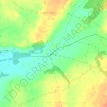
Naam: Topografische kaart Carrig Bridge, hoogte, reliëf.
Gemiddelde hoogte: 84 m
Minimale hoogte: 62 m
Maximale hoogte: 107 m
Andere topografische kaarten
Klik op een kaart om zijn topografie, zijn hoogte en zijn reliëf te bekijken.
Kinnity
Ireland > County Offaly > The Municipal District of Birr
Kinnity, The Municipal District of Birr, County Offaly, Leinster, Ireland
Gemiddelde hoogte: 251 m
Shinrone
Ireland > County Offaly > The Municipal District of Birr > Shinrone
Shinrone, The Municipal District of Birr, County Offaly, Leinster, Ireland
Gemiddelde hoogte: 72 m