
Topografische kaart Mangateretere
Interactieve kaart
Klik op de kaart om de hoogte weer te geven.
Over deze kaart
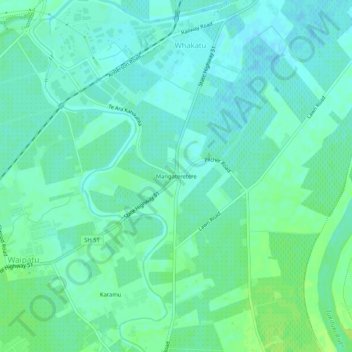
Naam: Topografische kaart Mangateretere, hoogte, reliëf.
Gemiddelde hoogte: 9 m
Minimale hoogte: 4 m
Maximale hoogte: 16 m
Andere topografische kaarten
Klik op een kaart om zijn topografie, zijn hoogte en zijn reliëf te bekijken.
Twyford
New Zealand > Hawke's Bay > Hastings District > Hastings
Twyford, Hastings, Hastings District, Hawke's Bay, 4154, New Zealand
Gemiddelde hoogte: 19 m
Matangi
New Zealand > Hawke's Bay > Hastings District > Hastings
Matangi, Hastings, Hastings District, Hawke's Bay, 4295, New Zealand
Gemiddelde hoogte: 187 m