
Topografische kaart Awutu Senya East Municipal District
Interactieve kaart
Klik op de kaart om de hoogte weer te geven.
Over deze kaart
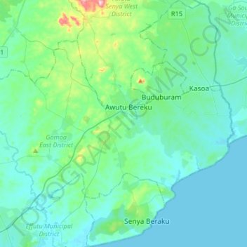
Naam: Topografische kaart Awutu Senya East Municipal District, hoogte, reliëf.
Locatie: Awutu Senya East Municipal District, Central, Ghana (5.36490 -0.55932 5.62615 -0.41441)
Gemiddelde hoogte: 43 m
Minimale hoogte: 0 m
Maximale hoogte: 313 m