
Topografische kaart Bayard
Interactieve kaart
Klik op de kaart om de hoogte weer te geven.
Over deze kaart
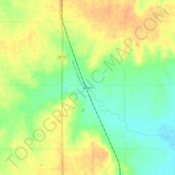
Naam: Topografische kaart Bayard, hoogte, reliëf.
Locatie: Bayard, Allen County, Kansas, United States (37.97364 -95.18303 38.01364 -95.14303)
Gemiddelde hoogte: 321 m
Minimale hoogte: 301 m
Maximale hoogte: 337 m
Andere topografische kaarten
Klik op een kaart om zijn topografie, zijn hoogte en zijn reliëf te bekijken.
Moran
United States > Kansas > Allen County
Moran, Allen County, Kansas, United States
Gemiddelde hoogte: 334 m
Mildred
United States > Kansas > Allen County
Mildred, Allen County, Kansas, United States
Gemiddelde hoogte: 321 m
Mildred Lake
United States > Kansas > Allen County > Mildred
Mildred Lake, Mildred, Allen County, Kansas, United States
Gemiddelde hoogte: 320 m