
Topografische kaart The Greens
Interactieve kaart
Klik op de kaart om de hoogte weer te geven.
Over deze kaart
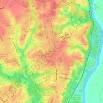
Naam: Topografische kaart The Greens, hoogte, reliëf.
Gemiddelde hoogte: 52 m
Minimale hoogte: 14 m
Maximale hoogte: 76 m
Andere topografische kaarten
Klik op een kaart om zijn topografie, zijn hoogte en zijn reliëf te bekijken.
Hillendale
United States > North Carolina > Cumberland County > Fayetteville
Hillendale, Fayetteville, Cumberland County, North Carolina, 28311, United States
Gemiddelde hoogte: 61 m
Winter Park
United States > North Carolina > Cumberland County > Fayetteville
Winter Park, Fayetteville, Cumberland County, North Carolina, 28304, United States
Gemiddelde hoogte: 58 m
Williams Village
United States > North Carolina > Cumberland County > Fayetteville
Williams Village, Fayetteville, Cumberland County, North Carolina, 28301, United States
Gemiddelde hoogte: 30 m