
Topografische kaart Castellcir
Interactieve kaart
Klik op de kaart om de hoogte weer te geven.
Over deze kaart
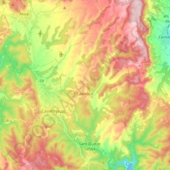
Naam: Topografische kaart Castellcir, hoogte, reliëf.
Locatie: Castellcir, Moianès, Barcelona, Cataluña, España (41.73309 2.04210 41.80092 2.18920)
Gemiddelde hoogte: 739 m
Minimale hoogte: 466 m
Maximale hoogte: 1.014 m