
Topografische kaart San Francisco del Rincón
Interactieve kaart
Klik op de kaart om de hoogte weer te geven.
San Francisco del Rincón
The settlement was founded as San Francisco del Tule on January 21, 1607 by a group of families of the Purépecha and Hñähñu (Otomi) ethnicities. It was declared a villa (town) on September 6, 1865 and a city on March 27, 1867. It is located at 21°01′22″N 101°51′36″W / 21.02278°N 101.86000°W / 21.02278; -101.86000, at an approximate altitude of 1,721 meters.
Over deze kaart
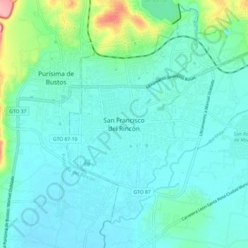
Naam: Topografische kaart San Francisco del Rincón, hoogte, reliëf.
Locatie: San Francisco del Rincón, Guanajuato, 36300, Mexico (20.97667 -101.89462 21.05667 -101.81462)
Gemiddelde hoogte: 1.767 m
Minimale hoogte: 1.745 m
Maximale hoogte: 1.874 m