
Topografische kaart Donnybrook
Interactieve kaart
Klik op de kaart om de hoogte weer te geven.
Over deze kaart
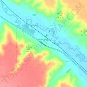
Naam: Topografische kaart Donnybrook, hoogte, reliëf.
Locatie: Donnybrook, Ward County, North Dakota, United States (48.50267 -101.89797 48.51390 -101.86984)
Gemiddelde hoogte: 569 m
Minimale hoogte: 531 m
Maximale hoogte: 618 m